Humminbird LakeMaster Premium France V2 handleiding
Handleiding
Je bekijkt pagina 22 van 27
22
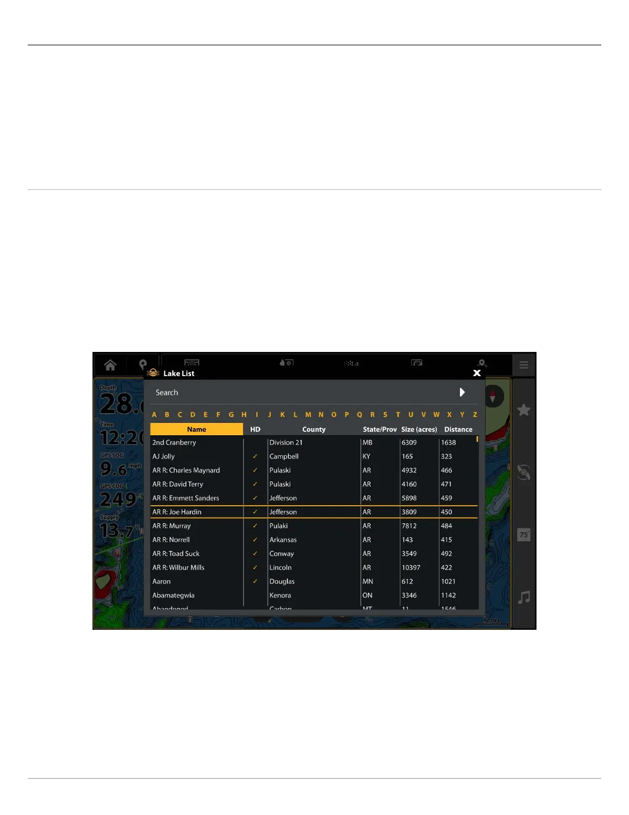
Display a Lake
Display a Lake
The lake map displayed on the Chart View is based on the latitude/longitude position and the map card installed in the fish finder.
GPS reception is required for the correct lake to be displayed.
The Lake List menu option allows you to display a different lake from the installed LakeMaster Map Card. When you select a lake,
the cursor will move to the lake so you can see it on the Chart View. Then, you can mark waypoints, press the GOTO key to start
navigation toward a waypoint, or press the CHECK/INFO key for more information.
No GPS Reception: If you don’t have a GPS Fix, you can view the lake in Simulator mode. When you power on the fish finder, select
Simulator from the Start-Up Options Menu. You can mark waypoints and routes and save them in Simulator mode.
Display a Lake
1. From the Chart X-Press Menu, select Info.
2. Select Lake List.
Sort: Tap column headers, or use the Cursor pad/Joystick and Enter key, to sort the list. Tap a second time to reverse the
order of the lakes listed. You can sort by name, county, size, or identify the high-definition lakes (Hi-Def) on your card, etc.
Scroll: Swipe, or use the Cursor pad/Joystick, to scroll through the list.
Cursor To: Select a lake on the list and tap, or press the Enter key.
QUICK TIP! You can also search for a lake by name using the on-screen keyboard.
Selecting a Lake to Display
Bekijk gratis de handleiding van Humminbird LakeMaster Premium France V2, stel vragen en lees de antwoorden op veelvoorkomende problemen, of gebruik onze assistent om sneller informatie in de handleiding te vinden of uitleg te krijgen over specifieke functies.
Productinformatie
| Merk | Humminbird |
| Model | LakeMaster Premium France V2 |
| Categorie | Niet gecategoriseerd |
| Taal | Nederlands |
| Grootte | 14440 MB |


