Humminbird LakeMaster Premium France V2 handleiding
Handleiding
Je bekijkt pagina 21 van 27
21
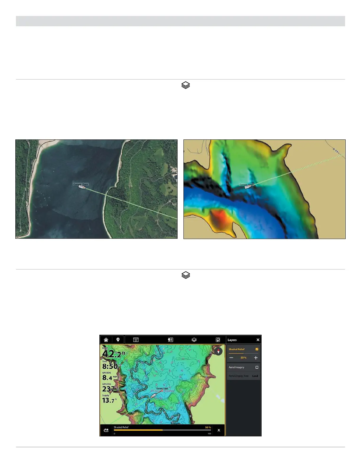
Adjust the Map Display Settings
Change Layers
(LakeMaster Premium Chart Cards Only)
If you have a LakeMaster Premium map card, you can display layers that show aerial imagery (available for select lakes only) or
shaded relief in Chart View and Chart Combo views. The transparency of these layers is customizable.
∆ Aerial Imagery can be applied to land only or to both land and water.
∆ Shaded Relief uses shadows to show features of the lakebed.
Show/Hide Layers
1. With a Chart view displayed on-screen, tap the Layers icon
in the Top Bar.
OR
From the Chart X-Press Menu, select Settings > Layers.
2. Select a layer. Tap, or press the ENTER key, to show or hide it. (check mark = visible, blank = hidden)
Aerial Imagery (Land and Water) Shaded Relief
Adjust Transparency of Layers
1. With a Chart view displayed on-screen, tap the Layers icon
in the Top Bar.
OR
From the Chart X-Press Menu, select Settings > Layers.
2. Select the layer you want to adjust.
3. Press and drag the slider, or press the +/- ZOOM keys, to adjust the setting. (0% = transparent, 100% = opaque)
Layer Transparency
Bekijk gratis de handleiding van Humminbird LakeMaster Premium France V2, stel vragen en lees de antwoorden op veelvoorkomende problemen, of gebruik onze assistent om sneller informatie in de handleiding te vinden of uitleg te krijgen over specifieke functies.
Productinformatie
| Merk | Humminbird |
| Model | LakeMaster Premium France V2 |
| Categorie | Niet gecategoriseerd |
| Taal | Nederlands |
| Grootte | 14440 MB |


