Magellan GPS 320 handleiding
Handleiding
Je bekijkt pagina 21 van 78
Magellan GPS 315/GPS 320 13
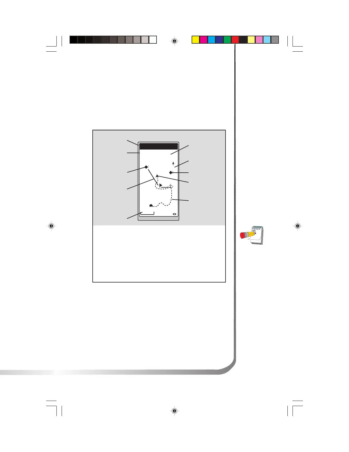
Using the Plot Screen
The PLOT screen is a mini map that shows where you have
traveled and where you want to travel. You can view the
active route, your current position and the other waypoints
and destination in the PLOT screen.
TO: FISH
BRG
351
m
DST
3.52
m
I
2.0
m
I
N
HOME
FISH 2
FISH
DOCK
BUOY
°
Distance to
Destination
North Indicator
Waypoint Icon
Current Position
Icon
Track History
Plot Scale
Active Route
Destination Icon
Bearing to
Destination
Destination
Name
Active Route
Indicates the direction
required to reach your
destination.
Plot Scale Can be
changed by using the
left/right arrows. The
scale ranges from .1 to
200 miles.
PAN-N-SCAN, an
additional feature,
allows you to scroll
through the PLOT
screen enabling you
to create waypoints
and GOTOs.
Track History
Automatically records
where you have been.
Bekijk gratis de handleiding van Magellan GPS 320, stel vragen en lees de antwoorden op veelvoorkomende problemen, of gebruik onze assistent om sneller informatie in de handleiding te vinden of uitleg te krijgen over specifieke functies.
Productinformatie
| Merk | Magellan |
| Model | GPS 320 |
| Categorie | Niet gecategoriseerd |
| Taal | Nederlands |
| Grootte | 10344 MB |


