Furuno TZTF19F handleiding
Handleiding
Je bekijkt pagina 4 van 20
44
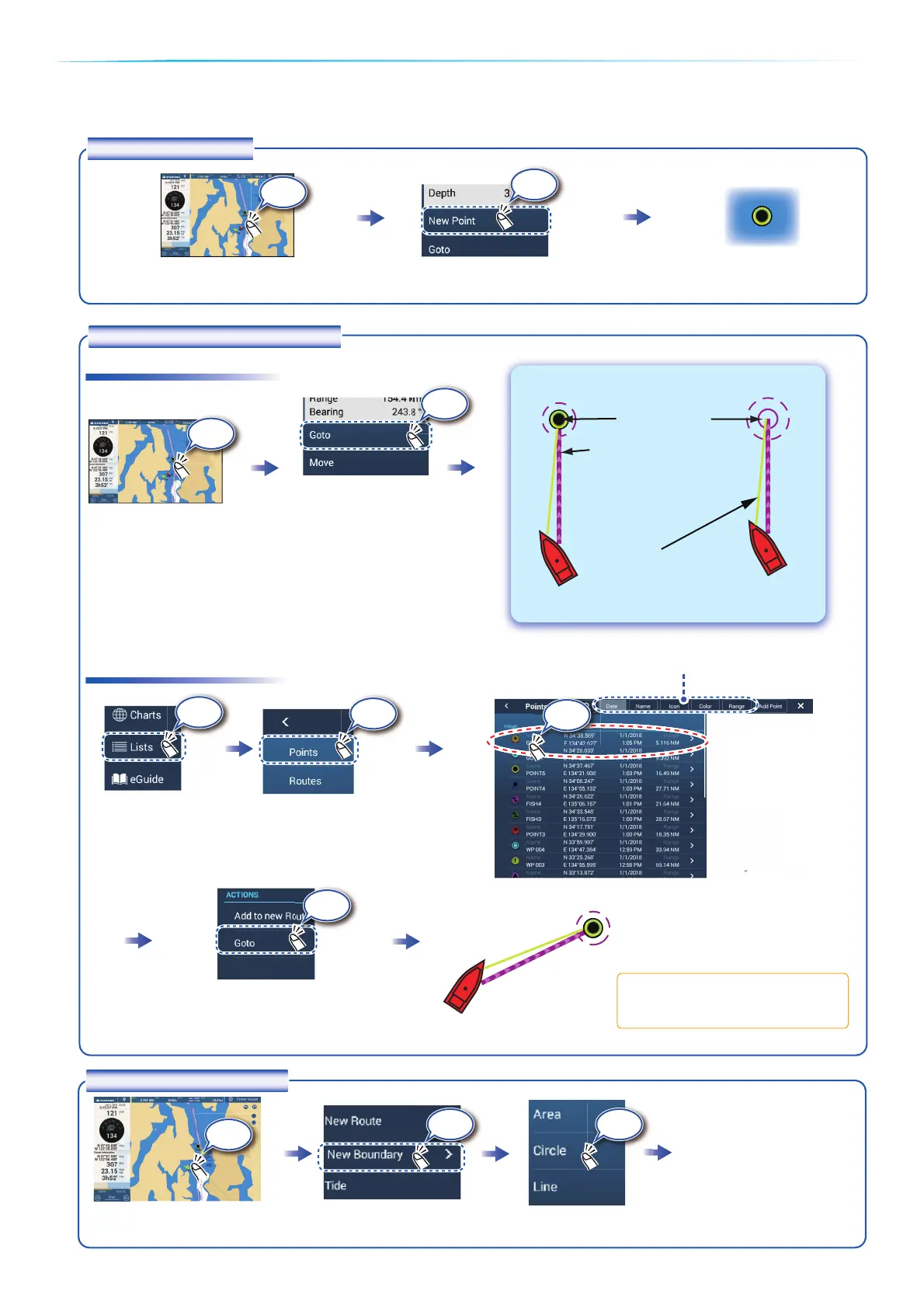
Points/boundaries
Points can be entered on the chart plotter display (radar, fish finder and weather displays also) to mark important
locations such as a good fishing spot. Point attributes (position, symbol type, color, etc.) are recorded to the Points
list. Also, boundaries can be set at the position desired (net position, area to avoid, etc.).
Tap where to enter a point.
The point is entered
on the screen.
Tap a point or the location
to set as destination.
On-screen point Selected location
On-screen pointOn-screen point
Points listPoints list
How to enter a point
Yellow line:
Shortest course from own
ship to the destination.
Purple line (with arrow):
Indicates course to go to
the destination.
How to set a point as destination
Tap [Lists] on the
home screen.
Destination point
Lists
If a point was tapped.
NoticeNoticeNoticeNoticeNotice
Note: [Find on Chart] puts the
selected point at the screen center.
Sort the list by date, name, icon, color, range.
How to set a boundary
Tap the position where to
set a boundary.
Tap the shape to use for
the boundary.
[Area]/[Line]: Tap neces-
sary points to complete
the boundary, referring to
"Route" on the next page.
[Circle]: Drag icons to
adjust the size and
position, and then tap
[End Boundary].
Tap Tap
Tap
Tap
Tap
Tap
Tap
Tap the point to set as the destination.Tap the point to set as the destination.
㻙
Tap
Tap
Tap
+
-
+
-
Find on Chart
Tap
Bekijk gratis de handleiding van Furuno TZTF19F, stel vragen en lees de antwoorden op veelvoorkomende problemen, of gebruik onze assistent om sneller informatie in de handleiding te vinden of uitleg te krijgen over specifieke functies.
Productinformatie
| Merk | Furuno |
| Model | TZTF19F |
| Categorie | Niet gecategoriseerd |
| Taal | Nederlands |
| Grootte | 7676 MB |


