Bosch FlexiDome IP 4000i handleiding
Handleiding
Je bekijkt pagina 32 van 86
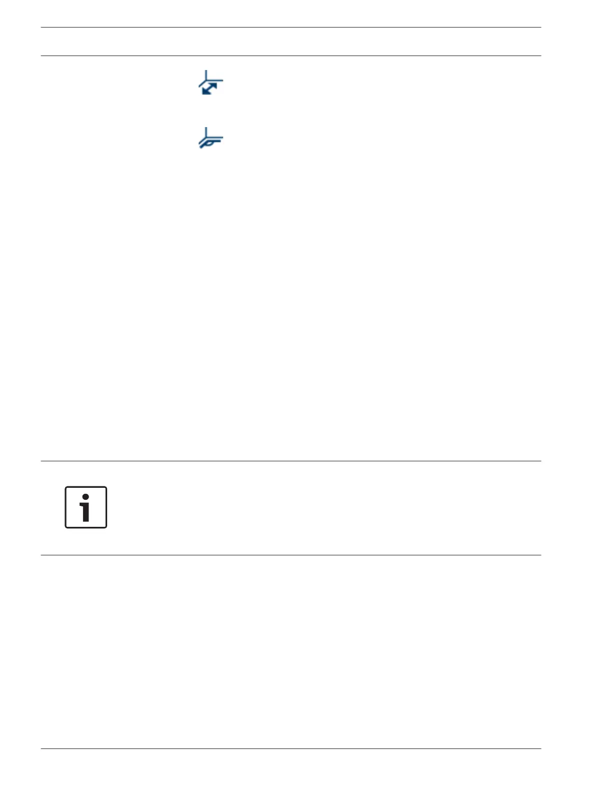
– Click to place a line across the ground in the image.
A line on ground corresponds to a line that is on the ground plane, such as a road
marking.
– Click
to place an angle on the ground in the image.
The angle on ground represents an angle lying on the horizontal ground plane, such
as the corner of a carpet or parking bay markings.
3. Adjust the calibration elements to the situation:
– Enter the real size of a line or angle. To do this, select the line or angle, then enter
the size in the corresponding box.
Example: You have placed a line on ground across the lower side of an automobile.
You know that the automobile is 4 m long. Enter 4 m as the length of the line.
– Adjust the position or length of a line or angle. To do this, drag the line or angle or
move the end points to the desired position in the camera image.
– Remove a line or angle. To do this, select the line or angle, then click the trash can
icon.
Note:
Blue lines indicate calibration elements added by you.
White lines represent the element as it should be positioned on the camera image based
on the current calibration results or the determined calibration data.
Horizon
If the values correspond, areas on the camera image have a colored background.
blue: This area corresponds to the sky. The bottom line of the blue area represents the
horizon. Objects that are detected in the blue area cannot be filtered correctly by size or
speed.
If the camera is installed at a relatively low height in a building, for example, this display is not
required, because the entire area covered by the camera is below the horizon.
Notice!
If the distance to the camera (geolocation) is not relevant, it is enough to determine height
and focal length in relation to each other. This allows a simple calibration by marking 2-3
persons ‑ each with a vertical line ‑ and setting their size. 1,80 m (71 in.) for all is sufficient.
Use at least one person in the front and one person in the background of the image for best
results.
Coordinate system
Select the coordinate system and enter the appropriate values in the additional input fields
that appear depending on the coordinate system selected.
The Coordinate system feature describes the position of the camera in a local Cartesian or
the global WGS 84coordinate system. The camera and the objects tracked by the video
analytics are displayed on a map.
Cartesian
The Cartesian coordinate system describes each point in the space by a combination of the
position on three orthogonal axes X, Y and Z. A right-handed coordinate system is used, where
X and Y span the ground plane and Z describes the elevation of the ground plane.
X [m]
The location of the camera on the ground on the X-axis.
32 en | Configuration - Camera Camera Browser Interface
2017.09 | v1.0 | Software manual Bosch Security Systems
Bekijk gratis de handleiding van Bosch FlexiDome IP 4000i, stel vragen en lees de antwoorden op veelvoorkomende problemen, of gebruik onze assistent om sneller informatie in de handleiding te vinden of uitleg te krijgen over specifieke functies.
Productinformatie
| Merk | Bosch |
| Model | FlexiDome IP 4000i |
| Categorie | Bewakingscamera |
| Taal | Nederlands |
| Grootte | 4703 MB |


