Alpine HVS-HB0X handleiding
Handleiding
Je bekijkt pagina 8 van 66
8
Preface
Navigation terminology
Navigation
The navigation system displays and tracks the
vehicle's position and movement on a moving map
display. When a destination is input, the navigation
system quickly calculates a route and guides you
along the route with pictorial displays and voice
prompts.
Present vehicle position
The navigation system integrates the GPS signals
received and the map information stored on the CD
ROM to display the position and direction of the
vehicle. The system also includes a gyroscope and
a speed sensor that enable it to display the present
position even in locations where the GPS signal may
be blocked.
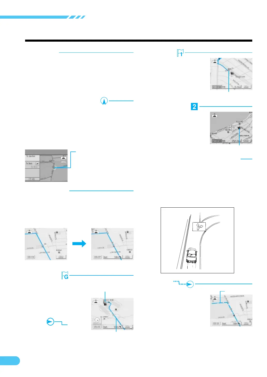
Waypoints
You specify points you wish
to pass by along the way to
your destination and they are
indicated with the waypoint
icons in the display.
Memory points
Locations you go to
frequently can be stored into
memory and marked on the
map. The system can store
up to 100 points, including
your home.
waypoint icon
Memory point mark
Motorway-preference selection
When searching for routes with the navigation
system, you can switch between searching for
routes that give priority to motorways and those that
give priority to ordinary roads. When you specify
motorway preference, the navigation system
automatically searches for a route that gives priority
to motorways and guides you along that route.
Track
Map matching
Since GPS navigation has an error of 100 – 655 feet
(30 m – 200 m), the position of your vehicle may be
displayed off the road. Map matching automatically
corrects this error so that the position of your vehicle
is displayed on the road.
Uncorrected
Corrected
Destination
The point on the map that is
your destination is specified
and displayed with the
destination icon.
Route
When a destination is input,
the navigation system
automatically calculates a
route and displays it in blue
on the map.
Destination mark
Tracking
The tracks indicate the roads
you have driven over with
blue dots. There is a limit on
the amount of memory
available for storing your
tracks (up to 31 miles/50 km).
When you exceed this
memory capacity, the tracks
are erased starting from the
earliest portion.
Present vehicle position
Route
Bekijk gratis de handleiding van Alpine HVS-HB0X, stel vragen en lees de antwoorden op veelvoorkomende problemen, of gebruik onze assistent om sneller informatie in de handleiding te vinden of uitleg te krijgen over specifieke functies.
Productinformatie
| Merk | Alpine |
| Model | HVS-HB0X |
| Categorie | Niet gecategoriseerd |
| Taal | Nederlands |
| Grootte | 12915 MB |


